There is a new way to think about the road trip.
It isn’t about checking off the biggest attractions. It isn’t necessarily about driving the farthest, visiting the most states, or cramming six museums into a Saturday.
It’s about maximizing the experience.
Call it History Maxxing.
The phrase borrows from the internet’s increasingly popular “-maxxing” vocabulary—the idea of going all-in on a particular interest or experience. “Trip-maxxing,” for example, is already being used to describe travelers packing more culture and destinations into a single journey.
For history-minded travelers, though, I think there’s a more interesting opportunity.
What if we could maximize the history already hiding in the places we’re driving through?
For destinations, that doesn’t necessarily mean building another museum or developing another major attraction.
Sometimes, it means making the history that’s already there easier to find.
And Illinois offers some excellent examples.
The Problem: History Is Often Hiding in Plain Sight
One of my favorite things about road trips is realizing that the place I almost drove past has a story.
The old courthouse.
The statue in the park.
The canal towpath.
The building with an unusual cornice.
The faded industrial building.
The mural on the side of a downtown business.
The problem is that travelers don’t always know what they’re looking at.
A visitor may drive through a historic downtown, see a beautiful building, and never know that it is significant.
They may park three blocks from a museum and never realize it exists.
They may walk past a historic site because there is no obvious indication that something important happened there.
This is where wayfinding becomes interpretation.
Good wayfinding doesn’t simply tell visitors where to turn.
It answers a much more important question:
“Why should I stop here?”
History Maxxing Starts With Wayfinding
Think about the difference between a sign that says:
HISTORIC DISTRICT →
and one that says:
HISTORIC DISTRICT → Lincoln-Douglas Debate Site • 1858 Historic Courthouse • Canal Town
The second sign has already begun telling a story.
It creates curiosity.
It gives the traveler a reason to turn the steering wheel.
And once you’ve convinced someone to make that turn, you have an opportunity to introduce them to everything else that destination has to offer.
This is particularly important for small and mid-sized communities.
Travelers aren’t necessarily looking for a single blockbuster attraction. They are looking for layers.
History + architecture + public art + food + shopping + a scenic drive + a good cup of coffee.
That’s the History Maxxing road trip.
Ottawa, Illinois: Turn the City Into a History Hunt
Ottawa is one of my favorite examples of this approach.
Located at the confluence of the Illinois and Fox Rivers, Ottawa has a remarkable collection of stories: the Illinois & Michigan Canal, the first Lincoln-Douglas debate, the city’s industrial history, the Underground Railroad, the Radium Dial story, and the people who helped shape the community.
But one of the smartest ways Ottawa makes that history accessible is through public art.
The city’s murals aren’t simply decorative backdrops for selfies. They tell stories.
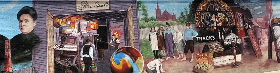
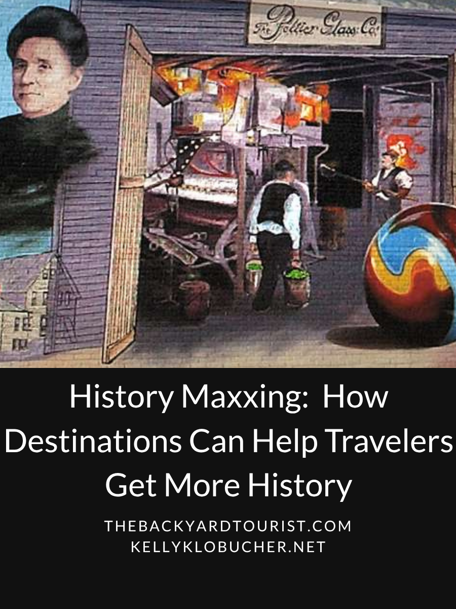
Ottawa’s downtown murals depict subjects including Native American history, the Lincoln-Douglas debate, Civil War history, the Peltier Glass Factory, the I&M Canal and other aspects of the community’s past.
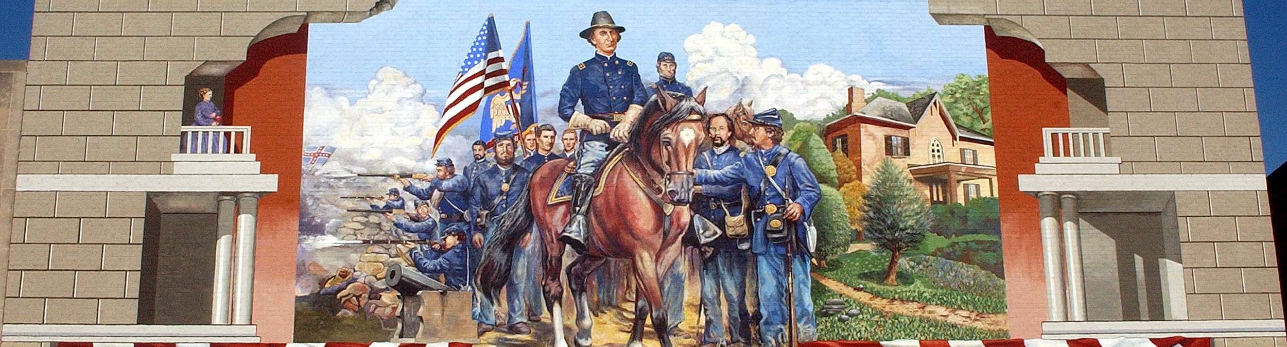
The city has also developed self-guided experiences around that history, including its Brush with History mural tour. Ottawa’s comprehensive plan specifically identifies the Brush with History tour as a way for visitors to learn about the city’s murals, alongside the self-guided Ottawa Heritage Tour.
That’s brilliant tourism infrastructure.
You don’t have to convince a visitor to spend three hours inside a museum.
You can tell them:
“Go find the stories.”
Suddenly, downtown becomes a scavenger hunt.
And that’s History Maxxing.
Make the Road Itself Part of the Story
Another powerful approach is to stop treating the drive between attractions as dead space.
The Illinois & Michigan Canal National Heritage Corridor has long understood this.
The canal itself is a historic landscape stretching across northeastern Illinois, connecting communities whose development was shaped by transportation, commerce and industry.
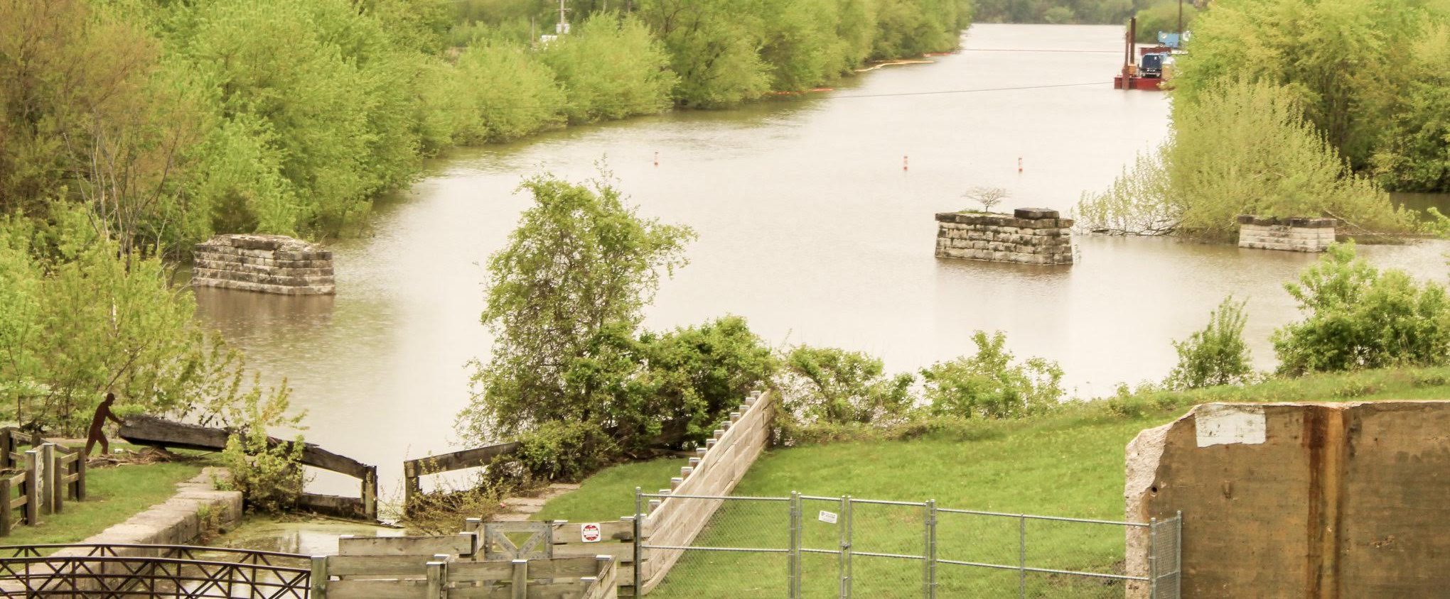
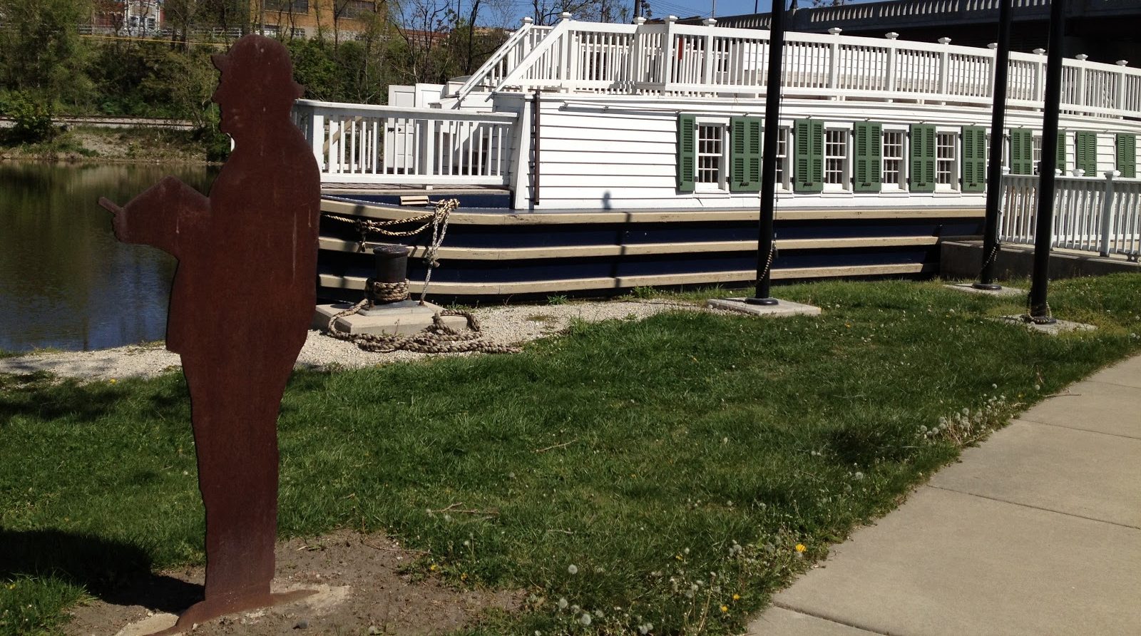
Its interpretive system has incorporated life-sized steel silhouettes of historical figures along the corridor. Documentation of the heritage corridor specifically notes the use of silhouettes as part of its interpretive system, including figures such as Civil War veteran Sgt. James Sanborn.
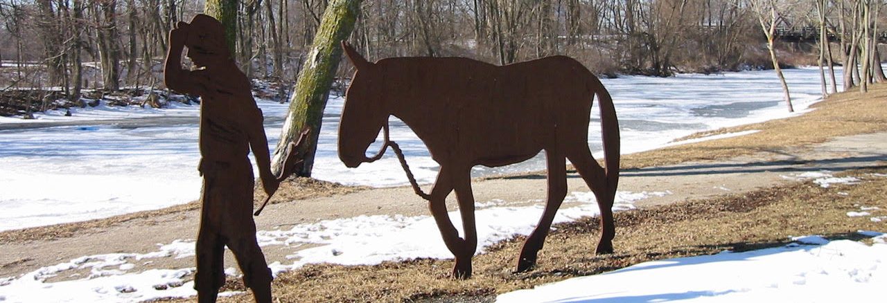
In Lockport, for example, silhouettes commemorate figures associated with the canal, including engineer William Gooding. Canal-related signage, mile markers and interpretive features help visitors understand that they’re not simply walking or driving through another Illinois town—they’re moving through a nationally significant transportation landscape.
This is a fundamentally different way of experiencing history.
Instead of:
Attraction → car → attraction → car → attraction
the entire journey becomes:
Story → landscape → story → landscape → story.
That’s what a good heritage corridor can do.
The Silhouette Driving Tour Is a Brilliant Idea
The silhouette concept is particularly effective because it solves one of the hardest problems in historical interpretation:
How do you make someone notice something that happened 150 years ago?
Put a recognizable human figure beside the road.
Now history has a face.
The traveler sees a person standing where that person once lived, worked or traveled.
The I&M Canal corridor has used this kind of interpretive strategy alongside maps, navigation signs and historical information. The result is something that feels less like a traditional museum exhibit and more like a road trip through a historical landscape.
And that’s exactly where destinations should be headed.
Don’t just tell travelers:
“There was a canal here.”
Show them where the canal shaped the town.
Show them who worked on it.
Show them what was transported.
Show them what the landscape looked like.
Then give them the next stop.
History should lead somewhere.
Looking for Lincoln: Turn a Person Into a Road Trip
Perhaps the best Illinois example of this idea is Looking for Lincoln.
The Abraham Lincoln National Heritage Area connects communities throughout central Illinois through the stories of Abraham Lincoln and the people, places and events associated with his life.
The genius isn’t simply that Lincoln is famous.
It’s that the program gives travelers a reason to connect seemingly unrelated places.
A courthouse in one town.
A home in another.
A debate site.
A railroad connection.
A monument.
A museum.
A wayside exhibit.
Together, they become a larger story.
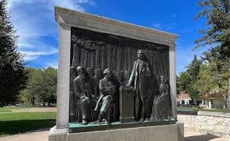
The Looking for Lincoln program has used wayside exhibits and interpretive infrastructure to help communities tell their local Lincoln stories. Earlier planning materials described the goal explicitly: visitors would be able to find Looking for Lincoln interpretive panels throughout participating communities, connecting individual stories into a larger heritage experience.
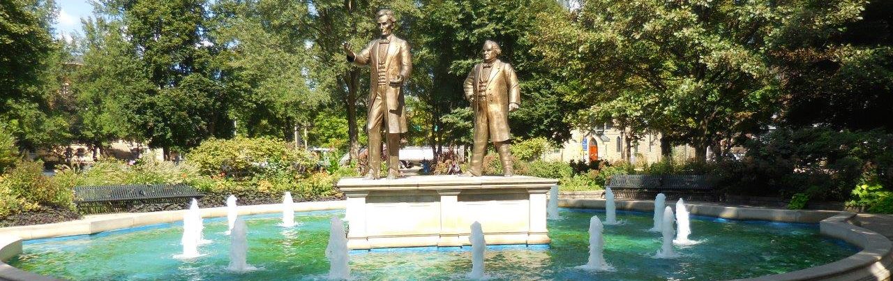
Today, the organization’s interactive map allows travelers to explore historic sites, visitor information, guided and self-guided experiences, and other destinations throughout the Abraham Lincoln National Heritage Area.
Its visitor guide also frames the region as a historic adventure, with highways and byways, a Looking for Lincoln Story Trail, historic attractions and communities all functioning as pieces of the larger experience.
That’s more than marketing.
It’s interpretive wayfinding at a regional scale.
The Lesson for Destination Marketers
Here’s what I think destination organizations should take from all of this:
You don’t necessarily need more attractions. You may need better connections between the attractions you already have.
A traveler might already be interested in your courthouse.
But can they find the historic neighborhood two blocks away?
They might know about your museum.
But do they know about the historic restaurant across the street?
They might stop at your famous monument.
But does anything tell them what happened here—and where they should go next?
History Maxxing is about creating those connections.
Put the history on the street.
Wayfinding signs.
Historic markers.
Murals.
Silhouettes.
Walking routes.
Driving tours.
Scenic byways.
QR codes.
Maps.
Audio tours.
Interpretive panels.
Passport programs.
Digital trails.
None of these has to be enormously expensive individually.
The power comes from connecting them.
Give Visitors Permission to Explore
One of the biggest mistakes destinations can make is assuming visitors will discover everything on their own.
They won’t.
Not because they’re uninterested.
Because they don’t know what they’re missing.
The best destination experiences make discovery easy.
They say:
“You’re here. Here’s what happened here.”
Then:
“Here’s where to go next.”
Then:
“Oh—and don’t miss this.”
That’s the difference between a collection of historic sites and a heritage experience.
Ottawa’s murals make visitors look for stories on downtown walls.
The I&M Canal’s interpretive system puts historical people and stories directly into the landscape.
Looking for Lincoln connects communities through a recognizable narrative that encourages visitors to keep following the story.
These are all versions of the same idea:
Don’t make history something visitors have to hunt for. Make the hunt the experience.
The Future of the Road Trip May Be More Historical
There is something wonderfully old-fashioned about this.
Before smartphones, before Google Maps, before every attraction was ranked and reviewed, road trips were partly about discovery.
You saw a sign.
You wondered what it meant.
You pulled over.
You explored.
History Maxxing brings some of that curiosity back—but with better tools.
For travelers, it means getting more out of the miles they’re already driving.
For destinations, it means turning overlooked assets into reasons to stop.
And for communities, it can mean something even more important:
helping visitors understand why this place matters.
So the next time you’re planning a road trip, don’t just ask:
“What is there to do?”
Ask:
“What happened here?”
Then look for the sign.
Find the mural.
Follow the silhouette.
Take the heritage route.
Read the plaque.
Make the detour.
And keep following the story.
Because the best road trips aren’t always the ones that take you the farthest.
They’re the ones that send you home knowing more than when you left.
That’s History Maxxing.


Leave a Reply